Department of Geodesy and Cartography
HISTORY OF THE DEPARTMENT
In 1949, simultaneously with the Faculty of Hydro-Reclamation, the Department of Geodesy and Graphics was established, headed by: associate professors M.N. Voidillo, V.A. Sokolov, V.K. Yanzen, Yu.I. Sidorenko, and Professor Y.M. Dodis. In 1992, the Department Hydro-Reclamation was organized Faculty of Land Management.
Further, in connection with the development of land and agrarian reform in the Kyrgyz Republic, there was a need for geodesic specialists. At the initiative of the State Cartographic and Geodetic Service of the Kyrgyz Republic, the training of engineers-geodesists began at the Kyrgyz National Agrarian University K. I. Scryabin. In 1996, the admission of students to a new specialty “Applied Geodesy” was opened at the Department of “Land Management and Geodesy”.
Since 2004, the Department of Land Management and Geodesy has been reformed into separate departments of “Land Management” and “Geodesy and Cartography”. The first head of the Department of Geodesy and Cartography was the Director General of the State Cartographic and Geodetic Service of the Kyrgyz Republic, Candidate of Technical Sciences V.E. Tsurkov. Due to the dynamically developing equipment and technologies in the field of Geodesy and cartography in the 2012-2013 academic year, the specialty “Applied Geodesy” was renamed into the specialty “Geodesy and remote sensing” and also received a license for the specialty “Cartography”.
From 2005 to 2012, the department was initiated by Ph.D. Associate Professor Sultanalieva Tursunbubu. From 2012 to 2019, the department was headed by Candidate of Technical Sciences, Acting Associate Professor Ermek Sharsheev. Since 2019, the persistent pastime of the department is headed by Doctor of Economics, Acting Professor Chortombaev Ulan.
To date, 3 senior lector work at the department in the state regime – Oleinikova Svetlana, Mamyralieva Venera, Konurbayeva Gulzat, 1 assistant – Zhumabekova Aigerim, 1 laboratory assistant – Medetbekova Baktygul
Directions and profiles/programs
Geodesy is one of the oldest sciences. The word “geodesy” is formed from two
words – “land” and “divide”, and the science itself arose as a result of practical
human activity to establish the boundaries of land plots,
the construction of irrigation canals, land drainage. Modern geodesy is a multifaceted science that solves complex scientific and practical problems. The main scientific task of geodesy is to determine the shape and size of the Earth and its external gravitational field. This science is about measuring the earth’s surface to display it on plans and maps.
The subject of applied geodesy is the study of methods of topographic and geodetic support for various economic tasks arising in construction production, in mining and exploration and mining, the study of natural resources and the study of the stability of structures and the Earth’s surface in space and time. In a narrower sense, applied geodesy studies methods of topographic and geodetic surveys, methods of making projects of structures in nature, and for this reason applied geodesy is sometimes called engineering, thereby emphasizing its close connection with engineering and construction production.
Remote sensing of the Earth (RSE) is the observation of the Earth’s surface by ground, aviation and space means equipped with various types of shooting equipment. The operating range of wavelengths received by the shooting equipment ranges from fractions of a micrometer (visible optical radiation) to meters (radio waves). Probing methods can be passive, that is, using natural reflected or secondary thermal radiation of objects on the Earth’s surface due to solar activity, and active — using forced radiation of objects initiated by an artificial directional source. Remote sensing data obtained from the spacecraft (spacecraft) are characterized by a high degree of dependence on the transparency of the atmosphere. Therefore, the spacecraft uses multi-channel equipment of passive and active types, registering electromagnetic radiation in various ranges.
Department composition
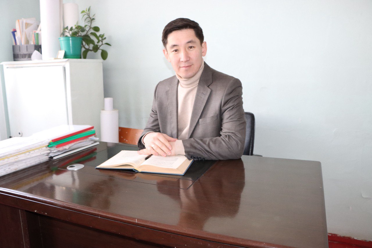
Karakozuev Izatbek Mametjumaevich
Head of Department
Султаналиева Турсунбубу Султаналиевна
E-mail: tursunsultanalieva@mail.ru
Summary
Surname and name: Chortombaev Ulan
Date of birth: 25.06.1980
Place of birth: Kyrgyz Republic, Bishkek City
Position and place works: Head of the Department of Geodesy and Cartography, Faculty of Hydroreclamation, Ecology and Land Management, Kyrgyz National Agrarian University named after K.I. Scriabin
Education: Higher
– 1997-2002 – KAU after named K.I. Scriabin; Faculty: “Hydroreclamation and land management” by specialty: engineer-land surveyor;
– 2004-2007 – KAU after named K.I. Scriabin; Institute: “Economics and Business”, specialty: finance and credit:
Academic degree: Doctor of Economic Sciences
Academic title: assistant professor
Awards:
– Diploma of KNAU them. K.I. Scriabin
– Honorary Diplom of the Ministry of Education and Science of the Kyrgyz Republic
Total work experience: 20 years
Experience:
2002-2003 – 2002-2003 – Specialist teacher disciplines at the Agrotechnical College. S. Ibraimov at KNAU im. K.I. Scriabin;
2012-2014 – Deputy Dean of the Faculty of Natural Resources Management KNAU named after. K.I. Scriabin;
2009-2013 – Senior Lecturer of the Department “Geodesy and Cartography” of the Faculty of Natural Resources Management KNAU named after. K.I. Scriabin;
2013-2016 – Acting Associate Professor of the Department of “Geodesy and Cartography” of the Faculty of Natural Resources Management KNAU named after. K.I. Scriabin;
2017 – Associate Professor of the Department “Geodesy and Cartography” of the Faculty of Hydroreclamation, Ecology and Land Management of KNAU named after. K.I. Scriabin;
05/27/2019 – Head of the Department of Geodesy and Cartography of the Faculty of Hydroreclamation, Ecology and Land Management of KNAU named after. K.I. Scriabin;
12/28/2021 – acting Professor of the Department of Geodesy and Cartography of the Faculty of Hydroreclamation, Ecology and Land Management KNAU named after. K.I. Scriabin.
Scientific research: in the field of geodesy and remote sensing, land management, agricultural economics.
Quantity published works: 42
readable disciplines: geodesy, remote sensing, photogrammetry.
Internships and advanced courses
qualifications:
01/07/2004 -31/08/2004 – Industrial practice Agricultural cooperative for the production of milk in Brandenburg (East Germany);
01/04/2005 – 30/09/2005 – Field trip Closed pig farm, agriculture and biogas in Bavaria (West Germany);
04/10/2005 – 01/03/2006 – University of Applied Sciences. Weinstephan, specialty: International master’s course in agricultural management. Tryzdorf;
25/10/2006 – 25/11/2006 – Undergraduate practice “Financial company for the support and development of credit unions” in the Credit Department, Bishkek, an intern;
03/05/2015 – 10/06/2015 – internship on “Green Economy” in China, Beijing;
27/02/2017 – 18/03/2017– internship in “Logistics of agricultural products” in Japan, Hokkaido Prefecture, Obihiro;
18/09/2017- 15/12/2017– internship on a doctoral dissertation on the topic: “Economic foundations for the efficient use of irrigated lands in the Kyrgyz Republic”, Rhein Waal University, Kleve, Germany;
9/08/2021-20/08/2021– summer school for the development of PhD doctoral studies and research potential in the Kyrgyz Republic, Cholpon-Ata City
Main scientific works:
- Methodology and features of the assessment of irrigated lands in the Kyrgyz Republic. Strategy for Innovative Development of the Agro-Industrial Complex in the Conditions of Economic Globalization: Proceedings of the International Scientific and Practical Conference. – Voronezh: Voronezh State Agrarian University, 2015. – 390s., p. 160-163 ISNB 978-5-7267-0811-9;
- The role and importance of irrigated lands in the development of the agricultural sector of the economy in the Kyrgyz Republic. Theoretical and scientific-practical journal “IZVESTIA” of the Orenburg State Agrarian University. Materials of the international scientific-practical conference “Problems of sustainability of bioresources and adaptive-landscape nature management in various environmental conditions” September 2015, Yalta No. 1(57)2016, p.8-10 ISSN 2073-0853;
- Economic assessment of irrigated lands in the Kyrgyz Republic.
Journal “Land management, cadastre and land monitoring” Scientific and practical monthly journal. No. 9 (September) (134)/2017. pp.66-69 ISSN 2074-7977
Languages: Kyrgyz (fluent); Russian (fluent); German (good); English (satisfactory)
Skills: computer literate
Contact address: Kyrgyz Republic, Bishkek, st. Mederova 68, Kyrgyz National Agrarian University. K.I. Scriabin, index: 720005
E-mail: ulan-chortombaev@mail.ru
Олейникова Светлана Анатольевна
E-mail: s.olejnikova@inbox.ru
Summary
Full name: Oleinikova Svetlana Anatolyevna
Date of birth 01.01.1957
Place of birth: Kyrgyzstan, Frunze
Position and place
Works: Senior Lecturer, Kyrgyz National Agrarian University. K.I. Scriabin
Higher education
Academic degree: –
Academic title: –
Awards:
1 Certificate of honor of KAU “For merits in the formation and development of the Department of Land Management”2002
2 Certificate of honor of the Central Committee of Trade Unions of the Agro-Industrial Complex of Kyrgyzstan “For conscientious work” 2003
3 4 Honorary diploma of the Ministry of Education “For contribution and conscientious work in improving pedagogical activity” 2005
5 Certificate of Honor of the Ministry of Agriculture, Water Resources and Processing Industry K R “2008
6 Certificate of honor “For fruitful and conscientious work in the training of mid-level professionals and with the 80th anniversary of the formation of the Agrotechnical College” 2010.
7 Certificate of honor in honor of the holiday “Day of Water Workers” for the contribution to the development of land reclamation in the Kyrgyz Republic and conscientious work in the training of young professionals. year 2012.
8 Badge “Excellent Geodetic Service” 2018
Total work experience: 37 years
Experience:
2009-2022 Senior lecturer of the department
Geodesy and cartography KNAU
2004-2009 Deputy Director of IEPR, Senior Lecturer of the Department of Geodesy and Cartography of KAU
1994-2004 Art. Lecturer of the Department of Geodesy KAU
1986-1994 Assistant at the Department of Geodesy and Graphics of the Kyrgyz Agricultural Institute
1985-1986 Art. laboratory assistant Geodesy and graphics Kyrgyz.SHI
1984-1985 Engineer of the Department of Capital Construction of Glavkirkgizvodstroy of the Ministry of Land Reclamation and VKh Kirg SSR
1981-1983 Engineer-economist Kant PMK, Sevvodstroy trust
Scientific
research:
Quantity
published
works: scientific articles in the Bulletin of KNAU-6, Scientific and methodical works-15
disciplines read: Geodesy, Applied geodesy, Satellite positioning technologies, Cadastral cartography, Geodesy training practice …
Internships and advanced courses
qualifications:
2018 – training “Review of the regulatory legal acts of the Kyrgyz Republic in the field of water resources use” Aarkhrus Center in Bishkek.
2006 – training course “Development of GIS technologies”
2006 – training course “Modern geodetic instruments” Royal Institute of Technology, Stockholm, Sweden
Main scientific works:
Knowledge of languages: Russian, English (with a dictionary)
Skills: Computer work: Windows 10, MS Excel. MS PowerPoint, Internet Explorer, etc.
Contact address: Bishkek, microdistrict 6, 38, apt. 4
Email: s. olejnikova@inbox.ru
Мамыралиева Венера Тологоновна
E-mail: mamyralievav@mail.ru
Summary
Full name: Mamyralieva Venera Tologonovna
Date of birth: 06/16/1974.
Place of Birth:
Talas city, Talas region, Leninpol district,
Klyuchevka village, st. Pushkin №14
Position and place
work: KNAU name of K.I. Scriabin
Senior Lecturer
Department of Geodesy and Cartography
Education: Higher
Academic degree: –
Academic title: –
Awards:
- Diploma (December 29, 2016), Certificate of honor (05/13/2016), Diploma 3 degree (May 20, 2016 ),Thank You Sheet (May 5, 2016), Diploma 3 degree (10/04/2019), Thank You Letter (10/15/2018 ), Diploma (2021), Diploma 3 degree (2022)
Total work experience: 24
Experience: 24
Research area:-
Number of published works:
- Integrated design
- Methods for determining the tilt of high-rise buildings using observations of foundation settlements
- AutoCAD Civil 3D environment: program analysis, methods and methods for processing geodetic survey data.
disciplines read: Descriptive geometry and engineering graphics, Engineering and computer graphics, Access and Visual Beisik, Engineering geodesy, Metrology, standardization and certification
Internship and advanced training courses:
- Certificate No. 007 on advanced training, according to license No. LE140000636 protocol number 5/16.25.04.2014.
- Certificate for participation in the training seminar, January 18-22, 2021.
- Certificate for participation in the seminar, June 6-7, 2017.
Main scientific works:
1.Research of modern information technologies in solving geodetic problems
Knowledge of languages: Russian, German (with a dictionary)
Skills: Windows OS, MS Word, MS Excel, MS Power Point, MS Access, AutoCAD, Civil 3D
Email: mamyralievav@mail.ru
Конурбаева Гулзат Уларбековна
E-mail: gulzatka87@mail.ru
Summary
Full Name: Konurbaeva Gulzat Ularbekovna
Date of Birth: 21.05.1987
Place of birth: Chui region, Almaluu village
Position and place of work:
KNAU named after K.I. Skryabin, FGMEiZU. Department of Geodesy and Cartography, senior lecturer.
Education:
2007 – Average. Hydrotechnical College of the Kyrgyz Agrarian University named after K. I. Skryabin, qualification “technologist-land surveyor”, specialty “Land management”
2011 – Higher. Kyrgyz Agrarian University named after K. I. Skryabin, qualification “Engineer”, specialty “Land Management”
2014 – Master. Kyrgyz State University of Construction, Transport and Architecture named after N. Isanov, academic degree – “master”, direction “Cartography and geoinformatics”
Academic degree: Master
Total work experience: 12 years
2010-2012 senior laboratory assistant of the department “Geodesy and Cartography”.
2012-2020 assistant of the department “Geodesy and Cartography”.
from 2020 to the present, senior lecturer of the department “Geodesy and Cartography”.
Experience: 10 years
Research area:
2014-2015 She was a junior research fellow of the project “Development of a remote sensing methodology for high-mountain pastures of the central Tien Shan based on satellite images”
Number of published works:
Published 3 articles, 1 of them was published in the Bulletin of KGUSTA named after
- Isanova.
3 educational and methodological instructions for coursework and practical work have been issued.
Readable disciplines:
Geodesy, TMOGI, Higher geodesy, Photogrammetry and remote sensing in modern agribusiness.
Internship and advanced training courses:
In April 2013 – GISCA 2013 Preconference Workshops, Kazakhstan, Almaty
Al-Farabi KazNU, certificate
In May 2013 – GISCA 2013 “Connected Regions: Societies, Economies and Environments”, Kazakhstan, Almaty Al-Farabi KazNU, certificate
2015 – “Introduction to a Green Economy: Concepts and Challanges”, Kazakhstan, Almaty Al-Farabi KazNU, certificate.
In January 2017, she completed advanced training courses “Innovative technologies in education”, certificate
In November 2018, she took part in the training “Overview of regulatory legal acts of the Kyrgyz Republic in the field of water use”, certificate
In December 2020, completed a training course on “Methodology and tools for online learning”, a certificate
In January 2021, took part in the seminar-training “Improving pedagogical skills in online learning”, certificate
February-March 2022 took part in the training seminar “Pedagogy and psychology. Application of information and communication technologies in the educational process”, certificate
Knowledge of languages: Russian, English (I read and translate with a dictionary)
Жумабекова Айгерим Жумабековна
E-mail: jumabekova_gdz@mail.ru
Summary
FULL NAME
Zhumabekova Aigerim Zhumabekovna
Date of Birth
12/14/199!
Place of work:
KNAU named after K.I. Scrуabin
Faculty of Нydromelioration, Ecology and Land Management, Department of Geodesy and Cartography
Position: Assistant
Education: KNAU named after K.I. Skryabin, Faculty of Natural Resources Management, majoring in Applied Geodesy
Academic degree- Academic title- Awards-
Total work experience: 7 years
Teaching – 4 years
Experience:
Research area:
Number of published works: 2 (articles)
Readable disciplines:
Remote sensing and photogrammetry Geoinformation systems and technologies Geodesy
Interpretation geoimages
Geodesy and photogrammetry in modern agribusiness Photogrammetry and remote sensing
Remote sensing for software Digital cartography
Internship and advanced training courses:
October 12-17, 2018, participant of the international seminar “CAWA” “Innovative tools for improved water management” November 24, 2018
Participant of the training “Review of regulatory legal acts of the Kyrgyz Republic in the area of water resources use” June 15-29, 2018,
Participant of the International Master’s School Kazakhstan, Almaty city, June-September 2018 Participant and curator from KNAU “World Nomad Games” 2018
Participant of the master class “Rules for compiling a resume” 2018
17.02. – 07/18/2019 exchange student (phd), project “Erasmus +” BOKU University, Austria, Vienna 15.06-01.07 2020 participant of the international webinar “Qgis basics, watershed tools, ternd earth and QM mapping”
Language proficiency: Certificate of English language proficiency “pre-intermediate” level
Skills: goal oriented, ability to work in a team
Contact address: 68 Mederova
Email: jumabekovagdz@gmail.com
Медетбекова Бактыгүл Медетбековна
Summary
Surname and name: Medetbekova Baktygul
Date of birth: 18.06.2000
Place of birth: Kyrgyz Republic, Bishkek City
Position and place works: Laboratory assistant of the Department of Geodesy and Cartography
Experience:
15/09/2021 – Laboratory assistant of the Department of Geodesy and Cartography
Internships and advanced courses
qualifications:
February-March 2022 took part in the training seminar “Pedagogy and psychology. Application of information and communication technologies in the educational process”, certificate
Languages: Kyrgyz (fluent); Russian (fluent); German (good); English (satisfactory)
Skills: computer literate
Contact address: Kyrgyz Republic, Bishkek, st. Mederova 68, Kyrgyz National Agrarian University. K.I. Scriabin, index: 720005
E-mail: medetbekova1806@gmail.com