Department of Land and Water Management.
History and mission of the department
- History and Modernity
The department was founded in 1991 under the name “Land Management” and is one of the youngest and most dynamically developing structures of the faculty. Over the years of its existence, the department has gone through several stages of transformation, responding to the challenges of the time and the needs of the economy:
- 1991 — Foundation of the Department of Land Management.
- 1996 — The first graduation of specialists (29 land surveying engineers).
- Oct. 2018 – Renaming into the Department of Land Management and Cadastres with the start of training bachelors and masters in the direction 620200 – “Land Management and Cadastres”.
- Oct. 2024 — Obtaining a new name for the department — “Land and Water Management”.
- Oct. 2025 — As part of the optimization of the university structure, a reorganization was carried out by merging the Department of Geodesy and Cartography with the Department of Land and Water Management.
The origins of the formation of the department are inextricably linked with the works of outstanding specialists: Candidate of Economic Sciences, Associate Professor Ismailova K.Ch., Professor Denisov V.V., Associate Professor Chimkanaev N.A., as well as teachers Vandaeva N.N., Osmonbaev N.T. and others.
- Mission and goals
The main goal of the department is to train highly qualified specialists with competencies in the field of:
- Land management, land management;
- Land and Agrarian Legal Relations and Cadastre;
- Topography, Geodesy and Cartography.
- GIS technologies and remote sensing of lands;
- Water Management and Water Diplomacy.
The department strives to provide the labor market with personnel capable of applying modern technologies and knowledge of the legal framework for the sustainable development of the agricultural sector and the country’s economy, solving issues of food security.
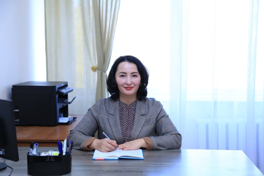
- Leadership of the Department
Since May 2017, the department has been headed by Candidate of Technical Sciences, Associate Professor Ainura Zhaparbekovna Batykova.
- He is the author of more than 100 scientific papers and 8 patents for inventions of the Kyrgyz Republic.
- Excellence in water management of the Kyrgyz Republic.
- Member of the Council of the UMO in the direction of “Land Management and Cadastres” at the State Healthcare Institution (Moscow) and KATiU named after S. Seifullin (Astana, Kazakhstan) in the direction of “Land Management and Cadastres”
- Educational programs and prospects
The department is actively working to expand educational programs, profiles and introduce international standards:
- Direction 620200 “Land Management and Cadastres” – bachelor’s and master’s degrees.
- The field of study “Geodesy and Remote Sensing” is a bachelor’s and master’s degree.
- The direction “Jurisprudence” (profile: land and agrarian law) was launched in the 2025-2026 academic year – bachelor’s and master’s degrees.
- Master’s program (profile) “Water Management” is planned to be opened in the 2026-2027 academic year (within the framework of the Erasmus + HWCA project) to train specialists with in-depth knowledge in water law and water resources management in Central Asia.
A double-degree education program is being implemented jointly with S. Seifullin KATiU (Astana, Kazakhstan), in the direction of “Land Management and Cadastres” (master’s degree).
- Material and technical base and innovations
The department actively introduces information technologies into the educational process:
- GIS Lab (2018): Equipped with computers to collect, analyze, model, and visualize spatial data.
- Water Management Laboratory (2023): Opened under the Erasmus+ HWCA project for research in the field of climate resilience and water security in Central Asia.
- GIS Learning Lab (2025): A new space with state-of-the-art computers and surveying equipment.
- Teaching staff of the department
The educational process is provided by highly qualified specialists:
- Head of the Department, Associate Professor, Candidate of Technical Sciences, Ainura Batykova.
- Professors: Candidate of Economic Sciences Denisov V.V., Doctor of Technical Sciences Kopnov V.A., Doctor of Economic Sciences Supayeva G.T.
- Associate Professors: Ph.D. Sultanalieva T.S., Ph.D. Sukenbaev A.S., Ph.D. Shabikova G.A., Ph.D. in Economics Associate Professor Rasheva A.T. and others.
- Senior lecturers: Zhusupova A.K., Bazarbayeva I.D., Mamyralieva V., Zhumabekova A., Borovskaya N.N., Slynko V.S., Alekseev N.Y. and others.
- Specialists: GIS specialists Bakhmutov E., Emilbekova A., senior laboratory assistant Amangeldieva B.
The staff of the department has published 7 textbooks with the stamp of the Ministry of Education and Science of the Kyrgyz Republic and 2 monographs (since 2017) and more than 30 methodological instructions.
- International cooperation
The department is integrated into the international educational space:
- State University of Land Management (GUZ, Moscow): Cooperation since 2002. Participation in the development of educational and methodological documents of the UMO.
- Erasmus+ projects: Active participation in grant programs (HWCA) for the development of water management.
- Projects of the Asian Development Bank and other international projects.
- Our alumni
The pride of the department is its graduates who hold key positions in government agencies (State Agency for Land Resources, etc.).
Notable alumni include:
- Seyitkazieva Erkaim Alymovna (2015 graduate) – Deputy of the Jogorku Kenesh of the Kyrgyz Republic of the VIII convocation, 2026
- Many of our graduates occupy responsible positions in government bodies and local government bodies (keneshes).
- Holders of red diplomas of the first graduation (1996): Abdiev A.S., Sooronova N.A., Tashtanov B.T., Goncharova E.V.
Directions and profiles / programs
Profile: “Geodesy and Remote Sensing” – Graduates majoring in “Geodesy and Remote Sensing” are qualified specialists capable of working in design and research institutes engaged in topographic, geodetic, and cartographic activities, as well as in organizations involved in natural resource monitoring, Earth remote sensing, and geoinformation technologies.
Specialists of this profile are able to perform geodetic and cartographic surveys, analyze satellite data, develop digital maps and terrain models, and apply modern remote sensing methods to solve scientific and practical tasks.
Profile: “Land and Agrarian Law”– Graduates majoring in “Land and Agrarian Law” are specialists with in-depth knowledge in the field of legal regulation of land and agrarian relations. They are trained to work in state and municipal bodies responsible for the management and use of land resources, in judicial and law enforcement institutions, in legal departments of agricultural enterprises, as well as in research and educational institutions.
Specialists of this profile are capable of professionally drafting and analyzing regulatory legal acts, resolving land disputes, ensuring legal protection of the rights and interests of landowners and land users, and providing consultations on land, water, environmental, and agrarian legislation of the Kyrgyz Republic.
Profile: Land management– Graduates majoring in Land Management are versatile specialists prepared to work in the State Agency for Land Resources, Cadastre, Geodesy and Cartography under the Cabinet of Ministers of the Kyrgyz Republic, the State Design Institute for Land Management “Kyrgyzgiprozem”, as well as in organizations engaged in economic and legal activities in the field of land management and regulation of land relations.
Profile: Land Cadastre – Graduates of the Land Cadastre program specialize in land and real estate valuation. Their work includes legal registration of land use, land accounting and valuation, state oversight of land use and protection, and land monitoring.
Graduates can work in the State Agency for Land Resources, Cadastre, Geodesy, and Cartography under the Cabinet of Ministers of the Kyrgyz Republic, the State Register under the State Registration Service, local governments (city halls, aiyl aimaks), architecture and urban planning departments, real estate firms, land and real estate appraisal agencies, construction companies, banks, and other agencies.
Profile: Geodetic support in land management– Bachelor’s degrees in Geodetic Support for Land Management are designed for professional work in the field of ground-based surveying, remote sensing, and computer processing of these materials, followed by presentation of the information in electronic and traditional formats. They also conduct topographic surveys and compile and publish maps and atlases for various purposes.
Graduates can work at the State Institution for Geodesy and Cartography, the State Agency for Land Resources, Cadastre, Geodesy, and Cartography under the Cabinet of Ministers of the Kyrgyz Republic, the State Register under the State Registration Service, local governments (city halls, aiyl aimaks), private design and survey firms, construction organizations (housing, civil, and road construction), architecture and construction departments, and others.
Profile: Water Resources Management – The goal of the Master’s program in Water Resources Management is to train highly qualified specialists with a systematic understanding of modern principles of sustainable water resources management, capable of developing and implementing innovative solutions in the water sector. The program is aimed at developing in-depth theoretical knowledge and practical skills in water use planning, monitoring, and evaluation, taking into account climate change, social sustainability, and the national sustainable development priorities of the Kyrgyz Republic.
The composition of the department
Batykova Ainura Zhaparbekovna
Head of the Department of Land Management and Cadastres, candidate of technical sciences, docent
aj.batykova@gmail.com
Denisov Vitaly Viktorovich
denisov49@list.ru
SUMMARY
Personal information:
Nationality: Marital status: Residence address:
| Denisov Vitaliy Date of birth: 29.12.1949. Frunze (Bishkek). Russian Not married Bishkek, 64 Karalayev str., apt. 154 |
Education: | 1977. Higher. Moscow Institute of Land Management Engineers (now the State University for Land Management). Specialty: land management. Diploma – “engineer land management”. 1987. PhD in Economics. Diploma. Decision of the Council of the Moscow Institute of Land Management Engineers. |
Work experience: | Total work experience 54 of them pedagogical 35 years. |
Professional experience: | 1987-1994. Senior Lecturer, Acting Associate Professor of the Department of Land Management of the Tashkent Institute of Irrigation Engineers and Agricultural Mechanization. 1994 – present Associate Professor, Acting Professor, Professor of the Department of Land Management and Cadastre. 1998. Deputy Dean of the Faculty of Hydroreclamation and Land Management. 1999-2000. Head of the Department of Land Management and Geodesy. 2000 – 2002. Dean of the Faculty of Hydroreclamation and Land Management. 2002 -2005. Vice-Rector for Academic Affairs of the Kyrgyz Agrarian University named after K.I. Scriabin. 1996. Academic title of Associate Professor. Diploma. Decision of the Supreme Attestation Commission of the Kyrgyz Republic. 2015. Title of Honorary Professor of the State University for Land Management. Certificate. Decision of the Academic Council of the State University for Land Management (Moscow). 2017. Academic title of professor. Diploma. Decision of the Supreme Attestation Commission of the Kyrgyz Republic. |
Scientific and methodological work: | 2002-2014. Scientific supervisor of a number of state budget scientific topics. 2013. Prepared a candidate of economic sciences. 1998 to the present time the head of scientific work of graduate students and undergraduates. 2009. Co-author S.N. Volkov in the edition of the 9th volume of the textbook “Land management. Regional land management” (section Land management in areas with predominantly irrigated agriculture). 2009. Textbook “Land management in the conditions of irrigated agriculture”. (Co-authors Ismailova K.Ch., Osmonova A.S.). 2010. For the first time in the Kyrgyz Republic, the textbook “Land management in the Kyrgyz Republic” (co-author S.N. Volkov). 2014. Second supplemented and revised edition of the textbook “Land Management in the Kyrgyz Republic”. (Co-author S.N. Volkov). 2015. Textbook “Fundamentals of land management”. (Co-authors S.N. Volkov, K.Ch. Ismailova, A.Zh. Batykova). 2017. Textbook “Regulation of land relations”. (Co-authors S.N. Volkov, A.Zh. Batykova, K.Ch. Ismailova). 2019. Collective monograph. Features of the use of land resources in the conditions of the piedmont-plain geomorphological complex. Geoinformation technologies in monitoring and use of land resources. 2019. Textbook “Land reclamation of the Kyrgyz Republic”. (Co-authors S.B. Andrusevich, E.E. Drugaleva, A.Zh. Batykova). In the press. 2019. For the first time in the republic, a textbook on land management in the state language “Jerge zhaigashtyruunun negizderi”. (Co-authors S.N. Volkov, K.Ch. Ismailova, A.Zh. Batykova). 2002. to the present, member of the Educational and Methodological Council in the field of “Land management and cadastres” at the State University for Land Management. Member of the section of the educational and methodological association in the direction of “Land management and cadastres” of the Kyrgyz National Agrarian University. K.I. Scriabin. 1998. Member of the expert working group on the development of a package of laws on land (Land Code of the Kyrgyz Republic, etc.). Decree of the President of the Kyrgyz Republic. 2001. Member of the working commission for the development of draft laws of the Kyrgyz Republic “On land cadastre and land management”, “On land valuation”, “On land lease”. Order of the Prime Minister of the Kyrgyz Republic. 2003. Member of the working group to develop the Concept of the Agrarian Policy of the Kyrgyz Republic until 2010 and the Concept of the Land Policy of the Kyrgyz Republic until 2010. Order of the Prime Minister of the Kyrgyz Republic. 2019. Member of the expert group on amendments and additions to the current Land Code of the Kyrgyz Republic. Order of the Minister of Justice of the Kyrgyz Republic. 2006. Member of the biographical collection “Elite of Kyrgyzstan”. 2019. Member of the biographical directory “Professors and Doctors of Science in the field of land management and land cadastre”. Series “Scientific, Pedagogical and Cultural Heritage”. 1984-2019. Published 120 scientific and methodical works. |
Training: | 2006. Moscow. State University for Land Management. Short-term professional development. Improving the content and quality of training of specialists in land management and cadastres. 23.11.-2.12. 2006 Certificate of advanced training. 2010. Moscow. State University for Land Management. Short-term professional development. Design and implementation of the main educational programs of the university in the direction 120700 – Land management and cadastres during the transition to the system of federal educational standards. 14.05.-29.05.12. 2010 Certificate of advanced training. 2016. Moscow. State University for Land Management. Short-term professional development. Status and prospects for the development of land management and cadastres in the Russian Federation. 23.05-27.05. 2016 Certificate of advanced training. 2019. Moscow. State University for Land Management. International scientific and practical conference “Trends in the development of the institute of land management as a tool for the implementation of land policy and their legislative consolidation: domestic and foreign experience of the XX-XXI centuries.” 31.05. 2019 Conference participant certificate. |
Awards: | 1970. Medal. On behalf of the Presidium of the Supreme Soviet of the USSR, the medal “For military valor”. 1999. Honorary diploma of the Kyrgyz Agrarian Academy. 2002. Certificate of Honor from the State Agency for Registration of Rights to Real Estate under the Government of the Kyrgyz Republic. 2003. Honorary diploma of the Ministry of Education and Culture of the Kyrgyz Republic. 2003. Honorary diploma of the Kyrgyz Agrarian University named after. K.I. Scriabin. 2004. Diploma of the City Hall of Bishkek. 2005. Honorary diploma of the Kyrgyz Agrarian University named after. K.I. Scriabin. 2009. Diploma of the Kyrgyz State Design Institute for Land Management “Kyrgyzgiprozem”. 2009. Honorary diploma of the Kyrgyz National Agrarian University named after. K.I. Scriabin. 2010. Honorary diploma of the Agrotechnical College of the Kyrgyz National Agrarian University named after. K.I. Scriabin. 2011. Diploma of the State Registration Service under the Government of the Kyrgyz Republic. 2005. Badge “Excellence in Education of the Kyrgyz Republic” 2010. Badge “Excellent student of the State Register of the Kyrgyz Republic”. Certificate. 2018. Badge “Excellent worker of the State Registration Service under the Government of the Kyrgyz Republic”. Certificate. 2009. Honorary badge of the State University for Land Management “For the development of land management education.” Certificate. 2011. Silver badge of honor of the State University for Land Management. Certificate. 2014. Honorary badge of the State University for Land Management “For Merit to the University”. Certificate. 2015. Golden honorary academic badge of the State University for Land Management. Certificate. 2019. Breast medal “240 years of the State University for Land Management”. Certificate. |
Skills: | Windows 98/NT/2000/XP, MS Word, MS Excel, MS PowerPoint, Internet Explorer. |
Language: | Russian |
Vitaly Anatolyevich Kopnov
Sultanaliyeva Tursunbubu
SUMMARY
Full name: Sultanaliyeva Tursunbubu
Date of birth: April 15, 1954
Place of birth: Krasny Vostok village, Issyk-Ata District, Kyrgyz SSR
Position and place of work:
Kyrgyz National Agrarian University named after K.I. Skryabin,
Associate Professor, Department of Geodesy and Cartography
Education: Higher
Academic degree: Candidate of Technical Sciences
Academic title: Associate Professor
Awards:
- Honorary Certificate of the Ministry of Water Management (1995);
- Honorary Certificate of KNAU named after K.I. Skryabin (2002);
- Badge “Excellent Worker of Education of the Kyrgyz Republic” (Ministry of Education, Science and Youth Policy of the Kyrgyz Republic, 2006);
- Badge “Excellent Worker of Agriculture of the Kyrgyz Republic” (Ministry of Agriculture, Water Resources and Processing Industry of the Kyrgyz Republic, 2008);
- Badge “Excellent Worker of Geodesy and Cartography” (State Cartographic and Geodetic Service of the Kyrgyz Republic, 2018).
Total work experience: 49 years
Teaching experience: 44 years
Field of scientific research:
06.01.02 – Land Reclamation, Recultivation, and Land Protection
Number of published works: 52
Selected scientific works:
- The Role and Importance of Irrigated Lands in the Development of the Agrarian Sector of the Economy of the Kyrgyz Republic
- Continuity of Graphic Education as the Basis for Successful Mastery of Technical (Engineering) Professions
- Optimal Placement of On-Farm Irrigation and Collector-Drainage Networks as a Key to Efficient Use of Irrigated Lands
Courses taught:
Descriptive Geometry and Engineering Graphics;
Engineering and Computer Graphics;
Geodesy;
Introduction to the Specialty;
Design of Engineering and Geodetic Works;
Development of Cadastral Plans Using MapInfo;
Information Technologies in Geodesy and Remote Sensing;
Design of Aerial Surveying Using UAVs;
Geodesy in Land Reclamation;
Methods for the Creation and Development of State Geodetic Networks.
Internships and professional development courses:
- Certificate of Advanced Training No. ПК 0053172, from November 23 to December 29, 2015, on the topic: “Use of Interactive Technologies and Equipment in the Educational Process.”
- Certificate of participation in the seminar “Effective Formation and Updating of Academic Course Programs Using Special Automated Solutions of the IPR BOOKS Electronic Library System,” June 30, 2019.
Main scientific direction:
Research on land reclamation, recultivation, and land protection.
Languages: Russian, German (with dictionary)
Computer skills:
Windows OS, MS Word, MS Excel, MS PowerPoint, MS Access, AutoCAD, Civil 3D, SOLIDWORKS.
Contact address:
Bishkek city, Yeletsky Lane 87/1 tursunsultanalieva@mail.ru
Shabikova Gulmira Askarovna
sh. gulmira66 @gmail.com
SUMMARY
FULL NAME DATE OF BIRTH MARITAL STATUS ADDRESS | Shabikova Gulmira Askarovna 05.06.1966 Widow, I have three children Bishkek, 45B Masalieva str., kv 15
|
EDUCATION | Higher education, in 1983 she graduated from the Przheval Pedagogical Institute with a degree in geography with an additional specialty biology. Candidate of Technical Sciences, Associate Professor. |
WORK EXPERIENCE | General pedagogical 33 years |
WORK EXPERIENCE | From 17.08.1988 to 30.03.1990 .- biology teacher of secondary school No. 1 of Kara – Balta; From 05.06.1990 to 19.08.1996 – geography teacher of K. Marx Secondary school of Kara – Koo, Tonsky district; From 01.09.1996 to 30.03.1998 – biology teacher of secondary school AGES- 5 of Alamudun district; From 30.03.1998 to 10.12.1998 – leading specialist of Alamudun district Department of Education; From 10.12.1998 to 26.08.2002 – Director of the secondary school AGES – 5 of the Alamudun district; From 26.08.2002 to 25.08.2004 – leading specialist of the Alamudun Department of Education; From 25.08.2004 to 30.08.2012 – Director of Lebedinovskaya secondary school No. 3; From 01.09.2012 to 21.08.2014 – senior laboratory assistant of the Department of “ZCHS”, KRSU; From 01.09.2012 to 30.05.2014 – graduate student KRSU in the direction 05.20.00 “Safety of human activity”, profile “Safety in emergency situations” (correspondence form of training); From 21.08.2014 to 01.09.2017 – leading specialist of the educational and scientific laboratory “Mountain ecosystems” of the Department of “ZCHS”; From 01.09.2017 to 01.09.2018 – senior lecturer of the Department of “ZCHS”; From 01.09.2018 to the present – Associate professor of the Department of “ZCHS”. |
KNOWLEDGE OF LANGUAGES | Kyrgyz, Russian, English with dictionary |
PERSONAL QUALITIES | Responsibility, sociability, ability to work in a team. |
Sukenbaev Аidar Satybaldievich
aidar61@bk.ru
SUMMARY
Sukenbaev Аidar Satybaldievich
Date of birth | 25th March 1961, Sary-Bulak village, Jaiyl district, Chui regions |
Education
| 1979-1982 – Kyrgyz State University, Faculty of Physics 1982-1985 – Moscow Engineering Physics Institute, engineer-physicist 2006 – 2009 – Kyrgyz State Law Academy under the Government of the Kyrgyz Republic, jurisprudence |
Experience
|
State Institution “Cadastre” under the Land Resources Service under the Ministry of Agriculture of the Kyrgyz Republic From October 15, 2019 to the present – Chief Specialist of the Land Cadastre and Registration Department Geoinformation System Center under the Department under the State Registration Service From 2009 to October 15, 2019 – chief specialist in real estate market analysis Project Implementation Unit Department of the State Register of the Kyrgyz Republic From 2007-2013 – regional coordinator for monitoring and evaluating the activities of local registration offices, real estate market analyst. State Register Agency of the Kyrgyz Republic 24.08.2005 – 2007 – head real estate registration department State Property Committee of the Kyrgyz Republic 1996-2005 – chief expert of the mass privatization group, Deputy Head of the Department of Development and Privatization of Fuel and Energy Complex Facilities Kyrgyz Stock Exchange 1996 – August 1996 – Listing Department Specialist Institute of Physics of the National Academy of Sciences of the Kyrgyz Republic 1990 -1994 research assistant, Laboratory of Atomic Spectroscopy Kyrgyz State University 1987 – 1990 – postgraduate student of the Department of Experimental Physics and Plasma Physics, Faculty of Physics Institute of Physics of the National Academy of Sciences 1985 – 1987 – Senior Engineer of the Laboratory of Atomic Spectroscopy Moscow Engineering Physics Institute 1982 – 1985 – student Kyrgyz State University 1979 – 1982 – student 1978 – 1979 – laboratory assistant of the laboratory of solid state physics of the Faculty of Physics |
Technical skills | Working knowledge of MS Word, Excel, Lotus, Power Point, Access programs |
Scientific works
| Published 20 scientific papers, including 3 inventor’s certificates |
Knowledge of the language
| Kyrgyz – native, Russian – excellent, English – good |
Science degree
| PhD |
Zhusupova Aizhamal Kamalovna
aijamaljusupova76 @mail.ru
SUMMARY
Zhusupova Aizhamal Kamalovna General information: Date of birth 03/30/1976 Place of birth: Kyrgyz Republic, Frunze Nationality: Kyrgyz Family status: married, has 4 children |
Education:
Higher. Kyrgyz Agrarian Academy, faculty “Hydromelioration and land management”, specialty “Land management”
1997 – bachelor’s degree
1998 – diploma “engineer-land surveyor”
Kyrgyz National Agrarian University named after. K.I. Scriabin in the direction of “Land management and cadastres”
2018 – diploma – master
Position and place of work:
Senior Lecturer, Department of Land Management and Cadastre, Faculty of Hydroreclamation, Ecology and Land Management, Kyrgyz National Agrarian University named after K.I. Scriabin
Work experience: 24 years
Experience:
1997-2001 senior laboratory assistant of the department “Land management and geodesy”.
1998-2000 assistant of the department “Land management and geodesy”.
from 2001 to the present time, senior lecturer of the department “Land management and cadastres”.
In 2010, she approved the topic of the dissertation for the degree of candidate of economic sciences “Organization of pasture use in the context of reforming land relations in the Kyrgyz Republic (Chui depression)”.
2011-2013 was a junior researcher of the project “Integrated management of land and water resources in the northern part of the Issyk-Kul region”.
since 2022 has been a researcher on “Integrated management of land and water resources at the administrative-territorial and basin level in the Chui region using GIS technologies”
Educational work:
Is the curator of groups: ZUbk-1-21, ZUbr-2-21
Training:
In January 2006, she completed advanced training courses “Pedagogy and Psychology”, received a certificate
In June 2006, she took a training course on “Introduction of GIS”, received a certificate
2011 Certificate “Principles of real estate valuation” MOES, ASh No. 1646; Bishkek,
2015 Certificate “Introduction to a Green Economy: Concepts and Challenges”; Bishkek,
from 28.02.22 to 18.03.22 passed training courses for advanced training in “Psychology and Pedagogy” at the Kyrgyz National Agrarian University named after K.I. Scriabin
on March 23, 2022, she completed a refresher course under the program “Formation and assessment of reading literacy competencies” of the Republican Institute for Advanced Studies and Retraining of Pedagogical Workers under the Ministry of Education and Science, received a certificate
Scientific and methodological work:
– Published more than 20 articles, including 5 scientific articles in the RSCI, they are published in international journals.
-More than 20 educational and methodical instructions for coursework, practical and control work of classes in the direction of “Land management and cadastres” have been issued.
Awards:
2005 Diploma of the Kyrgyz Agrarian University.
2008 Certificate of honor from Gosregister.
2011 Excellent student of Gosregister
2015 Honorary diploma of the Kyrgyz National Agrarian University
2022 Certificate of Merit from the Land Resources Service under the Ministry of Agriculture.
Rasheva Ainura Talapaevna
aika_akbar@mail.ru
SUMMARY
Personal information: Nationality: Marital status: Residence address:
| Ainura Rasheva Date of birth: 17.08.1978. Kyrgyz Not married, has a son. Bishkek, st. Abay 2/3, apt. 38.
|
Education: | 1999. Bachelor degree with honors. Kyrgyz Agrarian Academy, Faculty “Hydromelioration and Land Management”, specialty “Land Management”. 2000. Diploma “engineer land management” with honors. Kyrgyz Agrarian Academy, Faculty “Hydromelioration and Land Management”, specialty “Land Management” 2018. Master’s degree in Land Management and Cadastre, with honors. |
Work experience: | General pedagogical 22 years |
Professional experience: | 1999-2001. Senior Laboratory Assistant of the Department of Land Management and Geodesy. 2001. Assistant of the Department of Land Management and Geodesy. 2002-2019. Senior Lecturer at the Department o “Land management and cadastres”. |
Scientific and methodological work: | 2014. I approved the topic of the thesis for the degree of Candidate of Economic Sciences “Agricultural Land Management on the basis of land cadastre information support (on the example of Issyk-Kul oblast of the Kyrgyz Republic”). 2011-2013. I was a junior researcher of the project “Integrated land-water management in the northern part of the Issyk-Kul region” 2021. Researcher of the project “Integrated management of land and water resources at the administrative-territorial and basin level in the Chui region using GIS technologies.” -More than 25 articles have been published, of which 21 are scientific articles in the Russian Science Citation Index; they are published in international and republican journals. More than 20 educational and methodological guidelines have been issued for the implementation of term papers, practical and control work classes in the direction of “Land management and cadastres -Collective monograph. Features of the use of land resources in the conditions of the piedmont-plain geomorphological complex. Geoinformation technologies in the monitoring and use of land resources: |
Educational work: | 2006-2011 she was the chairman of the Youth Committee of the KAU. K.I. Skryabina, until 2008 was a member of the Council of Young Scientists of KAU and the Kyrgyz Republic, and also until 2011 a member of the Council of KNAU, I am the curator of groups. |
Training: | 2001. Passed computer courses, I own a computer at a professional level (Word, MS Excel). 2002г. July-August had an internship in Gosregister, received a certificate “Cadastral Topographer”. The experience gained is used during the training 2003. Advanced training courses “On the theory of pedagogy and psychology” in the Kyrgyz Academy of Education, received a certificate. 2006г. Passed training courses on “Introduction of GIS”, received a certificate. 2007. Passed training courses on “Preventing AIDS” in the KSMA has a certificate. 2010. Participated in the international seminar “Development of an Integrated Financial Strategy for Sustainable Development of Land Resources” received a certificate. 2017. I took part in the II International Scientific and Practical Conference on the theme “The Role of Soil Science for Sustainable Development of Agriculture and Ecology” Certificate. 2018. Training “Review of regulatory legal acts of the Kyrgyz Republic in the field of water resources use”. Certificate. 2019. Refresher course on the development of educational standards based on competencies. Certificate. 2019. Training “Theory and methods of testing in the educational process.” Certificate. 2020. Accreditation of educational programs. Certificate 2020. GIS training SuperMap iDesktop. Certificate. 2020. Attendee of the “Carbon Benefits Project” Webinar. Certificate 2021. Improving pedagogical skills in online learning. Certificate. 2022. Refresher courses “On the theory of pedagogy and psychology”. Certificate. 2022. “Formation and evaluation of reading literacy competencies”. Certificate. There are more than 30 certificates for the advanced training course. |
Awards: | · Honorary Diploma of KAU im. K.I. Scriabin. 2006. · Honorary Diploma of the Youth Committee of the Kyrgyz Republic.2008. · Honorary Diploma of the Department of Cadastre and Registration of Rights to Real Estate under the State Registration Service.2011. · Diploma of the Ministry of Education and Science of the Kyrgyz Republic 2011. · Breastplate “Excellence in Gosregister” from the Department of Cadastre and Registration of Rights to Real Estate under the State Registration Service.2013. · Honorary Diploma of the Land Resources Service under the Ministry of Agriculture.2022. |
Skills: | Working on a computer: Windows 10, MS Office 13, MS Excel, MS PowerPoint, Internet Explorer, owns GIS programs IDecstop10i, AutoCAD. (there are certificates). |
Language: | Kyrgyz, Russian, English with dictionary |
Bazarbayeva Indira Daiyrbekovna
bazarbaeva.indira @mail.ru
SUMMARY
Information about yourself: Bazarbayeva Indira Dayyrbekovna General information: Date of birth 30.06.1985 Place of birth: Kyrgyz Republic, Bishkek Nationality: Kyrgyz |
Education:
2001-2005. Hydraulic Engineering College at the Kyrgyz Agrarian University named after K.I.Scriabin, land surveyor technician (diploma with honors).
2005-2009. Kyrgyz Agrarian University named after K.I. Scriabin,
land management Engineer
2016-2018. Kyrgyz National Agrarian University named after K.I. Scriabin in the direction of “Land Management and Cadastre”, academic degree-Master
Work experience: General teaching 11 years
Professional experience:
2010-2011 senior laboratory assistant of the department “Organization of transportation management of transport”;
2011– assistant of the Department “Land Management and Cadastre”;
From 2019 to the present, senior lecturer of the Department “Land Management and Cadastre”
Scientific and methodological work:
In 2021, she approved the topic of her dissertation for the degree of Candidate of Economic Sciences “Economic validity of the formation of prices for real estate in modern conditions” in 2021, a researcher of the project “Integrated management of land and water resources at the administrative-territorial and basin level in the Chui region using GIS technologies”.
-Published more than 15 articles;
-More than 10 educational and methodical instructions have been issued for the performance of course work, practical and control work of classes in the direction of “Land Management and cadastres”.
Educational work: Curator of the group: ZUmag-1-21, ZU(k)-1-20, ZU(r)-2-20
Professional development:
- 2011. Certificate “Principles of real estate valuation” MOiN, ASH No. 1646; Bishkek,
- “Technology of scientific research” Certificate, MOiN, No.150000442; Bishkek,
- Certificate “Introduction to a Green Economy: Concepts and Challenges” ; Bishkek,
2017 Certificate “The role of soil science for the sustainable development of agriculture and ecology” Bishkek, Kyrgyzstan
2018 Certificate “Review of regulatory legal acts of the Kyrgyz Republic in the field of water resources research” Bishkek, Kyrgyzstan
twothousandeighteen Training master class on the topic “Resume compilation Rules” Bishkek., Kyrgyzstan
2019 Certificate “Theory and methodology of application of testing in the educational process”; Bishkek, Kyrgyzstan
2019 Certificate “Advanced training in teaching”
- Certificate “Economic instruments of water resources and water management” Bishkek, Kyrgyzstan
- 2019. Certificate “Improvement of professional competence of university teachers” Bishkek, Kyrgyzstan
- Certificate “On GIS, data analysis, climatic and hydrological modeling and use of MODSNOW-Tool for snow cover monitoring” Almaty, Kazakhstan
- Certificate “Advanced training in accreditation” Bishkek. Kyrgyzstan
- Accreditation of educational programs. Certificate. twothousandtwenty Training “Introduction to the Central Asian Climate Information Platform (CAKIP)” Bishkek, Kyrgyzstan.
- Webinar titled “Carbon Benefits Project”.
- 2021. Certificate “Creation of a unified regional database on risk exposure for Central Asia: Characteristics of buildings, infrastructure and agricultural land in Tajikistan”, Tajikistan
- 2021. Certificate “Women’s participation in the implementation of the provisions of the Aarhus Convention in the field of ensuring environmental stability in the regions of the country” Aarhus Center Bishkek
- Improving pedagogical skills in online learning Bishkek, Kyrgyzstan
- Advanced training in “Psychology and pedagogy” Kyrgyzstan Bishkek, KNAU
- 2022. Advanced training according to the program “Formation and assessment of reader literacy competencies” Bishkek, Kyrgyzstan, Republican Institute of Advanced Training and Retraining of Teaching Staff at the Ministry of Education and Science of the Kyrgyz Republic
Achievement:
2015 Certificate of honor. For a great contribution to the creation of a system and retraining of personnel in the field of land management, cadastre, valuation and real estate management;
- Thank you letter. For a great contribution to the development of the state language in the field of education, Ministry of Education and Science of the Kyrgyz Republic;
2022 Certificate of Honor Land Resources Service under the Ministry of Agriculture;
Skills:
Working on a computer: Windows 10, MS Office 13, MS Excel, MS PowerPoint, Internet Explorer;
Knowledge of languages:
Kyrgyz, Russian, English secondary
Borovskaya Natalia Nikolaevna
SUMMARY
Full Name: Borovskaya Natalia Nikolaevna
Date of Birth: November 7, 1958
Place of Birth: Russia, Altai Krai, Kamni-na-Obi city
Place of Work: Kyrgyz National Agrarian University named after K.I. Skryabin,
Senior Lecturer, Department of Geodesy and Cartography
Education: Higher
Academic Degree: —
Academic Title: —
Awards:
— “Excellent Worker of Geodesy and Cartography” No. 230 (December 12, 2005);
— “Honorary Geodesist” No. 137P (December 20, 2011);
— “Veteran of Labor” No. 24 (February 9, 2023).
Total Work Experience: 48 years
Professional Experience:
1981–1999 — Enterprise No. 19, Engineer
1999–2001 — Kyrgyz Research Institute of Balneology and Rehabilitation of the Ministry of Health of the Kyrgyz Republic, Chief Manager
2001–2003 — State Cartographic and Geodetic Service of the Kyrgyz Republic, Engineer
2003 — State Cartographic and Geodetic Service, Category I Engineer
2007 — State Cartographic and Geodetic Service, Category I Geodesist
2008 — State Cartographic and Geodetic Service, Leading Engineer
2012 — Goscartography, Chief Specialist
2014 — Goscartography, Deputy Head of OVR Department
2017–2023 — Goscartography, Head of OVR Department
2023–present — Kyrgyz National Agrarian University named after K.I. Skryabin, Senior Lecturer
Courses Taught:
Geodesy, Applied Geodesy, Satellite Systems and Positioning Technologies, Space Geodesy, Design of Engineering and Topographic Works, Topographic Drawing.
Internships and Professional Development Courses:
— “Pedagogy and Psychology.” Certificate (January 26, 2005);
— “Unification of Height Datums (Gravity Potential Approach).” ECO Geomatics Committee Capacity Building Program, National Cartographic Center of Iran (Tehran, July 22–26, 2017). Certificate;
— “Operational Creation of Cartographic Materials Based on Remote Sensing Data.” Certificate No. 772406633516 (June 26, 2019, MIIGAiK);
— “IT Technologies in Education.” January 8–13, 2024. Certificate;
— As part of the academic mobility program, lectures on the discipline “Satellite Systems and Positioning Technologies” (4 credits) were delivered during the second semester of the 2024–2025 academic year. Certificate.
Languages: Russian, English (with dictionary)
Computer Skills: Windows, CorelDRAW, MAGNET Tools, AutoCAD, and others.
Contact Address: Chuy Region, Alamudun District, Tash-Debe village, 28 Bolnichnaya Street
Mamyralieva Venera Tologonovna
SUMMARY
Full name: Mamyralieva Venera Tologonovna
Date of birth: 06/16/1974.
Place of Birth:
Talas city, Talas region, Leninpol district,
Klyuchevka village, st. Pushkin №14
Position and place
work: KNAU name of K.I. Scriabin
Senior Lecturer
Department of Geodesy and Cartography
Education: Higher
Academic degree: –
Academic title: –
Awards:
Diploma (December 29, 2016), Certificate of honor (05/13/2016), Diploma 3 degree (May 20, 2016 ),Thank You Sheet (May 5, 2016), Diploma 3 degree (10/04/2019), Thank You Letter (10/15/2018 ), Diploma (2021), Diploma 3 degree (2022)
Total work experience: 24
Experience: 24
Research area:-
Number of published works:
Integrated design
Methods for determining the tilt of high-rise buildings using observations of foundation settlements
AutoCAD Civil 3D environment: program analysis, methods and methods for processing geodetic survey data.
disciplines read: Descriptive geometry and engineering graphics, Engineering and computer graphics, Access and Visual Beisik, Engineering geodesy, Metrology, standardization and certification
Internship and advanced training courses:
Certificate No. 007 on advanced training, according to license No. LE140000636 protocol number 5/16.25.04.2014.
Certificate for participation in the training seminar, January 18-22, 2021.
Certificate for participation in the seminar, June 6-7, 2017.
Main scientific works:
1.Research of modern information technologies in solving geodetic problems
Knowledge of languages: Russian, German (with a dictionary)
Skills: Windows OS, MS Word, MS Excel, MS Power Point, MS Access, AutoCAD, Civil 3D
Email: mamyralievav@mail.ru
Konurbaeva Gulzat Ularbekovna
SUMMARY
Full Name: Konurbaeva Gulzat Ularbekovna
Date of Birth: 21.05.1987
Place of birth: Chui region, Almaluu village
Position and place of work:
KNAU named after K.I. Skryabin, FGMEiZU. Department of Geodesy and Cartography, senior lecturer.
Education:
2007 – Average. Hydrotechnical College of the Kyrgyz Agrarian University named after K. I. Skryabin, qualification “technologist-land surveyor”, specialty “Land management”
2011 – Higher. Kyrgyz Agrarian University named after K. I. Skryabin, qualification “Engineer”, specialty “Land Management”
2014 – Master. Kyrgyz State University of Construction, Transport and Architecture named after N. Isanov, academic degree – “master”, direction “Cartography and geoinformatics”
Academic degree: Master
Total work experience: 12 years
2010-2012 senior laboratory assistant of the department “Geodesy and Cartography”.
2012-2020 assistant of the department “Geodesy and Cartography”.
from 2020 to the present, senior lecturer of the department “Geodesy and Cartography”.
Experience: 10 years
Research area:
2014-2015 She was a junior research fellow of the project “Development of a remote sensing methodology for high-mountain pastures of the central Tien Shan based on satellite images”
Number of published works:
Published 3 articles, 1 of them was published in the Bulletin of KGUSTA named after
3 educational and methodological instructions for coursework and practical work have been issued.
Readable disciplines:
Geodesy, TMOGI, Higher geodesy, Photogrammetry and remote sensing in modern agribusiness.
Internship and advanced training courses:
In April 2013 – GISCA 2013 Preconference Workshops, Kazakhstan, Almaty
Al-Farabi KazNU, certificate
In May 2013 – GISCA 2013 “Connected Regions: Societies, Economies and Environments”, Kazakhstan, Almaty Al-Farabi KazNU, certificate
2015 – “Introduction to a Green Economy: Concepts and Challanges”, Kazakhstan, Almaty Al-Farabi KazNU, certificate.
In January 2017, she completed advanced training courses “Innovative technologies in education”, certificate
In November 2018, she took part in the training “Overview of regulatory legal acts of the Kyrgyz Republic in the field of water use”, certificate
In December 2020, completed a training course on “Methodology and tools for online learning”, a certificate
In January 2021, took part in the seminar-training “Improving pedagogical skills in online learning”, certificate
February-March 2022 took part in the training seminar “Pedagogy and psychology. Application of information and communication technologies in the educational process”, certificate
Knowledge of languages: Russian, English (I read and translate with a dictionary)
Zhumabekova Aigerim Zhumabekovna
SUMMARY
FULL NAME: Zhumabekova Aigerim Zhumabekovna
Date of Birth: 12/14/199!
Place of work: KNAU named after K.I. Scrуabin
Faculty of Нydromelioration, Ecology and Land Management, Department of Geodesy and Cartography
Position: Assistant
Education: KNAU named after K.I. Skryabin, Faculty of Natural Resources Management, majoring in Applied Geodesy
Academic degree- Academic title- Awards-
Total work experience: 7 years
Teaching – 4 years
Experience:
Research area:
Number of published works: 2 (articles)
Readable disciplines:
Remote sensing and photogrammetry Geoinformation systems and technologies Geodesy
Interpretation geoimages
Geodesy and photogrammetry in modern agribusiness Photogrammetry and remote sensing
Remote sensing for software Digital cartography
Internship and advanced training courses:
October 12-17, 2018, participant of the international seminar “CAWA” “Innovative tools for improved water management” November 24, 2018
Participant of the training “Review of regulatory legal acts of the Kyrgyz Republic in the area of water resources use” June 15-29, 2018,
Participant of the International Master’s School Kazakhstan, Almaty city, June-September 2018 Participant and curator from KNAU “World Nomad Games” 2018
Participant of the master class “Rules for compiling a resume” 2018
17.02. – 07/18/2019 exchange student (phd), project “Erasmus +” BOKU University, Austria, Vienna 15.06-01.07 2020 participant of the international webinar “Qgis basics, watershed tools, ternd earth and QM mapping”
Language proficiency: Certificate of English language proficiency “pre-intermediate” level
Skills: goal oriented, ability to work in a team
Contact address: 68 Mederova
Email: jumabekovagdz@gmail.com